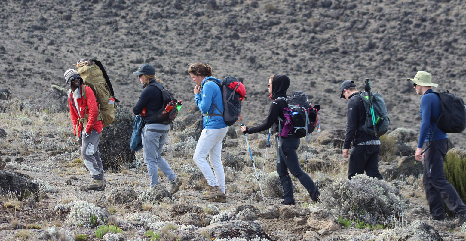
Climbing Machame in 7 days is very comfortable, and it provides enough time for acclimatization. No camp is skipped, and the route follows the pattern of hiking to a high altitude during the day and sleeping at a lower altitude at night.
7 DAYS KILIMANJARO MACHAME ROUTE

ITINERARY
The first part of the 11km trail from Machame gate at 1800m to Machame camp follows a gravel road and is very easy to walk. It is a gradual ascend and not very steep. You cross the rain forest and on the way you might see Black and White Colobus and Blue Monkeys. After a short lunch break the trail gets steeper and the forest gets thinner. If the weather conditions allow it, you will get a nice view of your ultimate destination, Kibo Peak, at the end of the day.
The way from Machame camp to Shira camp is only 5km long, but quite steep at the beginning. It leads through the moorland zone of the mountain. There are several viewpoints with a nice view of mount Meru, the forest you walked through on day 1, Shira and Kibo peaks.
After reaching the camp you can optionally take a short walk of about 45 minutes to 1 hour for acclimatization and a nice view of the sunset.
The way from Shira Cave to Baranco camp is 10km long and will take 6-7 hours, including lunch. At the beginning it will be a gradual walk to the junction point where we meet people from the Western routes. Join them and walk straight to Lava Tower (4600m), a 150m high volcanic lava plug that juts out of the side of mountain. The lunch will be at lava tower rest for few minutes then descend down to Baranco camp.
From Baranco camp to Karanga camp it takes 3 – 5 hours and distance is 6km and you will cross Breakfast or Baranco Wall, which is 300m high. The peak of the wall is at 4200m. This part is challenging because the trail is narrow and the number of hikers, porters and guides is large. In some parts you have to use your hands for climbing. You will cross the famous places called Kissing Rock. Shorty before Karanga Camp you will cross the Karanga Valley at 3930m which is the last point where porters can fetch water.
It will only take 3 to 4 hours to the cover distance of 4km from Karanga to Barafu Camp. It is gradual steep walk and (pole pole) slow walking is recommended for acclimatization. You will be in the alpine desert and at the left side you can see the Kibo Peak and few meters before Barafu you will cross the section occupied with Sedimentary rocks. Barafu camp is the dry camp but our team will carry water from Karanga valley.
Summit Night: You will wake up around 11:00pm, for some tea and snacks and dress up warm for the summit. At 12:00am you will start your summit with steep rocks for about 2 to 3 hours, and then you will start crossing the zigzag area and keep moving to the crater rim and finally Stella point, 5756m around 06:00amThis is the most mentally and physically challenging portion of the trek.
At Stella Point 5756m, you will stop for a short rest and will be rewarded with the most magnificent sunrise you are ever likely to see (weather permitting). From Stella Point, you may encounter snow all the way on your 1-hour ascent to the summit. At Uhuru Peak 5895m, you have reached the highest point on Mount Kilimanjaro and the continent of Africa. Faster hikers will see the sunrise from the summit.
From the summit, we now make our descent continuing straight down to the Mweka Hut camp site, stopping at Barafu for short rest and brunch.
The descend via Mweka route starts at Barafu camp via Millennium Camp 3797m. The way is steep, and it just takes only 2-3 hours to cover the 4km to Millennium Camp. You will pass from the alpine desert to the moorland zone.
From Millennium Camp to Mweka camp 3100m is also a steep walk which takes 2 – 3 hours for 3.5km. You will cross the moorland to the forest zone and on the way you will see Protea Kilimandscharica and Red Hot Poker and various other species of flowers and plants.
Mweka Camp to Mweka Gate: It is a long and steep downhill walk of about 10km which takes about 4-5 hour. The rain forest floor is wet and slippery, requiring careful and slow walking. You are again in the rain forest where you will see various species of flowers like Impatiens Kilimanjari and different trees species and also if your lucky you might see Blue Monkey and Black and White Colobus Monkeys.7 Days Machame Route
At the Mweka Gate:
Once you reach Mweka Gate you have to sign out in Kilimanjaro national park log book, our guide will collect certificate for those who made successful climb to Stella Point and Uhuru Point. Then we will drive you via Mweka village to your Hotel in Moshi for long shower and Kilimanjaro beer.
| NUMBER OF PEOPLE P/P | US DOLLAR |
|---|---|
| 1 Person | $2200 |
| 2-3 People | $2100 |
| 4-7 People | $2000 |
| 8-10 People | $1900 |
- >>Private transport to & from Kilimanjaro International Airport to your accommodations in Moshi.
- >>2 nights of accommodation in Moshi.
- >>Transportation to & from the Kilimanjaro gate
- >>Park entry fees,
- >>Camping fees.
- >>Team Kilimanjaro Rescue fees.
- >>18% VAT on tour fees & services.
- >>4 Season mountain tents
- >>Double layered Sleeping Mats
- >>Friendly and professional mountain guides, cook and porters.
- >>3 hot meals daily while on the mountain.
- >>Enough treated & filtered drinking water throughout the trek.
- >>Hot water for washing.
- >>Fair wages for the mountain crew as approved by the Kilimanjaro National Park Authority (KINAPA), Kilimanjaro Association of Tour Operators (KIATO)
- >>Government taxes
- >>Portable oxygen tanks & ox meter
- >>Emergency first-aid kit.
- >>Park entry fees,
- >>Tipping , usually $20 per guide, $15 per cook, 10 per porter ,all per each day .
- >>Lunches, dinners and drinks at your hotel before and after climb.
- >>Travel insurance
- >>Flights.,
- >>Laundry (Available at hotel).
- >>Personal items and toiletries.
MACHAME TREKKING DAYS

BASIC MOUNT KILIMANJARO INFORMATION
Weather summary:
January to March (Dry and Quiet season)
The weather in the first few months after the short rainy season is generally warm and dry. Away from the high season so relatively quiet, this is one of our favorite times to climb Kilimanjaro.
April and May (Long rainy Season)
The long rainy season in Tanzania normally occurs in April and May although it has become more unpredictable in recent years. If you don’t mind the rain you can have the mountain pretty much to yourself. And bear in mind you can nearly always get a good discount in this period.
June to November (Dry but busy season)
June to early November are the driest months for your Kilimanjaro climb but particularly during August to October this means the mountain is very busy. The shoulder months of June and July and early November are good compromises if a little rain doesn’t deter you.
November to Mid-December (Short Rainy Season)
The short rainy season normally starts towards the back end of November and continues for 3-4 weeks. Generally rain is less persistent than in the main rains and so this is a good time to be on the mountain without the crowds
Kilimanjaro’s climate zones
Climbers always say that mountains make their own weather and standing almost 6,000 meters in height, Kilimanjaro certainly has its own climate zones and the weather, along with the flora and fauna, changes drastically as you ascend the mountain.
These climate zones can be separated into 4 distinct areas. The first and lowest is the rain forest zone which extends from 800 meters up to 3,000 meters. The zone is warm and humid and attracts a fair amount of rain, especially in the wet season! At 2,800 meters the temperature averages between 12 – 15 degrees Celsius. This zone is where you are most likely to spot animals including the Blue and Colobus monkeys!
The second zone is known as the Low Alpine Area and extends from 3,000 meters to 4,200 meters. This is a semi-arid grassland zone with temperatures averaging between 5 and 10 degrees Celsius. Small shrubs and heather cover much of the landscape and the air is noticeably dyer compared to the humid lower reaches.
The third zone is known as the High Alpine zone. With an arid desert-like landscape, zone three extends from 4,200 meters to 5,000 meters with average temperatures around the freezing point. Temperatures in the day can actually be quite hot whilst at night the temperature plummets, so remember to bring some warm gear and some sunscreen!
The highest area is known as the Glacial zone and the temperature is usually below freezing with an average of -6 degrees Celsius. The area is often covered in snow and the high winds at this altitude make the temperature feel far lower than it is. Glacial silt cover the upper slopes and a number of huge glaciers can be seen from the crater rim of Kilimanjaro. At this height your body is getting half the oxygen it was at ground level, so don’t hang around!
Please remember that cold weather effects your body more at higher altitudes as your body is having to counter the effects of altitude in regards to oxygen levels. Your body extremities (feet, hands, nose etc.) will feel it most and -6 degrees could feel like -20 degree!
And remember that if it is raining at the bottom of the mountain it is almost certainly snowing at its summit.
Kilimanjaro Kit List
Underwear(4-5 pairs of sports underwear.),Base Layer,Trekking Shirts(4 x short sleeve shirts and 2 x long sleeve shirts.), Trekking Trousers(1-2 x pairs of hiking trousers),Insulation Layer,Core Jacket or Third Layer,Warm Jacket,Insulated Trousers, Hard Shell and Rain Gear,Kilimanjaro Sleeping Bags,Hat with Neck Cover,Beanie or Headband,Neck Warmer,Headlamp,Sunglasses Hiking Boots,Trekking Socks,Thermal Socks,Gaiters,Inner Gloves,Outer Gloves / Mitts,Trekking Poles,Duffle Bag with Raincover, Water Bottle,Hydration Bladder,Water Purification Tablets,Wet Wipes,Sweat Resistant Sunscreen.
How to avoid altitude sickness when Climbing Kilimanjaro
Altitude sickness, also called Acute Mountain Sickness (AMS), hypobaropathy and soroche, is an illness caused by exposure to the low air pressure, especially low partial pressure of oxygen, which many climbers experience at high altitudes.
AMS is caused by exerting yourself at high altitudes, especially if you have not been properly acclimatised. It is most common at altitudes above 2400 metres. Kilimanjaro’s peak is nearly 6000 metres above sea level. At this height, the air pressure (and the amount of oxygen it contains) is less than half that at sea level, and has been said to be comparable to ‘working with only one lung’.
AMS can be serious, especially as it can be debilitating, and it generally occurs far from places where medical treatment can be easily administered.
Not everyone suffers from AMS, of course, and it is very difficult to predict who is or is not vulnerable to it. Generally speaking, a fit person is less vulnerable than an unfit person, because their cardiovascular system can operate at low pressures longer without as much strain. Even so, anyone can be vulnerable at altitudes above 3500 metres, no matter their fitness level, if they have not spent some time getting used to the low atmospheric pressures first.
Undoubtedly the best way to see how you are going to react to high altitude is to go high and try to do some exercises. For most of us that isn’t an option so a good alternative is to have a session with a specialist altitude training company that have equipment that simulates the effects of altitude. In the UK the leading specialist is The Altitude Centre.
Avoiding AMS
- >>Walk high, sleep low. It is best to gradually climb higher each day, then descend lower to sleep. This lets you gradually become accustomed to lower pressures, and then recover somewhat overnight.
- >>Slow and steady. You need to keep your respiration rate low enough to maintain a normal conversation. If you are panting or breathing hard, you must slow down. Overworking your heart and lungs substantially increases your chance of becoming ill.
- >>Drink much more water than you think you need. Proper hydration helps acclimatisation dramatically. You need to drink at least three litres each day. As dehydration presents many of the same symptoms as altitude sickness, your chances of being allowed to continue are best if you stay hydrated.
- >>The general consensus of the research is that Diamox is helpful in avoiding AMS. We use it when climbing Kilimanjaro. We recommend you google Diamox and its effects yourself. It is a prescription drug, and you should consult with your doctor before taking it.
Effects of exposure to low atmospheric pressure
1.Low oxygen saturation
At high altitudes and low pressures, each breath takes in less oxygen, and transfers less to the blood. Blood with low levels of oxygen is said to be poorly saturated. Having slightly low oxygen saturation can lead to fatigue and feeling breathless. Severe low oxygen saturation can cause impaired mental functions, reduce your decision making ability, and have other dangerous effects. All our guides have pulse-oxymeters to check your oxygen saturation daily.
2.Cerebral oedema
Severely reduced air pressure can cause fluid to collect in the sinuses and air cavities in the skull. Initially it presents as a mild headache, but can eventually cause disorientation, coma and even death. Cerebral oedema can present very suddenly, and is an extremely serious medical issue
Pulmonary oedema
This is caused by reduced air pressure in the lungs. Fluid sometimes begins to seep from the lung tissues into the air spaces of the lungs, making breathing even more difficult. This often presents like pneumonia, and is most likely to occur during sleep.
How to recognise AMS
AMS does not present as a slow, gradual worsening of lesser altitude-related symptoms like breathlessness or headache. It is in fact generally a rapid, dramatic onset of symptoms that can render a person unable to walk or take care of themselves at all.
Our guides are trained to recognise AMS and apply the appropriate first aid. They will monitor your blood oxygen saturation and evaluate your overall acclimatisation, but it is vital that you monitor and report your condition accurately, for everyone’s safety.
Our client descent protocol
If our guides believe you may be in poor health or that allowing you to continue the climb may be dangerous, they will require you to begin your descent immediately. If that decision is made, it will be according to this protocol:
>>Measuring your oxygen saturation
If it is below 80%, then you will be required to submit to another test every half hour, for the next two hours. If your saturation does not rise to at least 75%, you will be required to descend immediately. If your saturation is at least 75%, you will be allowed to continue subject to close monitoring. If your condition worsens you must notify your guide immediately, and begin the descent.
>>Evaluation on the Lake Louise Scale
If your score is between 6 and 8 then the guide will consider whether you can continue based on your score, oxygen saturation levels, pulse rate and overall well-being. If you are allowed to continue, you will be monitored closely for the duration of the ascent. If your condition worsens you must notify your guide immediately, and begin the descent. If your Lake Louise Score is higher than 8, you must descend immediately.
KILIMANJARO TREKKING ROUTES


Which is the best route to climb Kilimanjaro?
Having helped so many people climb Kilimanjaro we know that for every one of them, the best route was the route which gave them the best chance to stand on the top of this awesome mountain. So there are just four routes up Kilimanjaro that we recommend: the Machame Route, Lemosho route, Rongai route and the Northern Circuit.
MACHAME ROUTE: This is our favourite route for a short climb as it offers a high chance of success over just 7 days. It has an interesting approach through all of Kilimanjaro’s diverse climate zones. Its downside is that everybody likes it, so in peak periods it can be very busy.
LEMOSHO ROUTE: Stepping up in cost and adding an extra day, this is the best 8 day route on the mountain. It has fantastic views and a really interesting approach from the West of the mountain.
NORTHERN CIRCUIT: If money and time are not an issue then it is worth checking out the Northern Circuit. It has the same attractive approach as the Lemosho but then heads north where you will find yourselves nearly alone.
RONGAI ROUTE: This route approaches Kilimanjaro from the north of the mountain close to the Kenyan border. It is a very quiet route, and is not normally our first choice as there is very little vegetation as it has much less rainfall. This means it is a good route to choose in the rainy season and it is always generally quiet.